
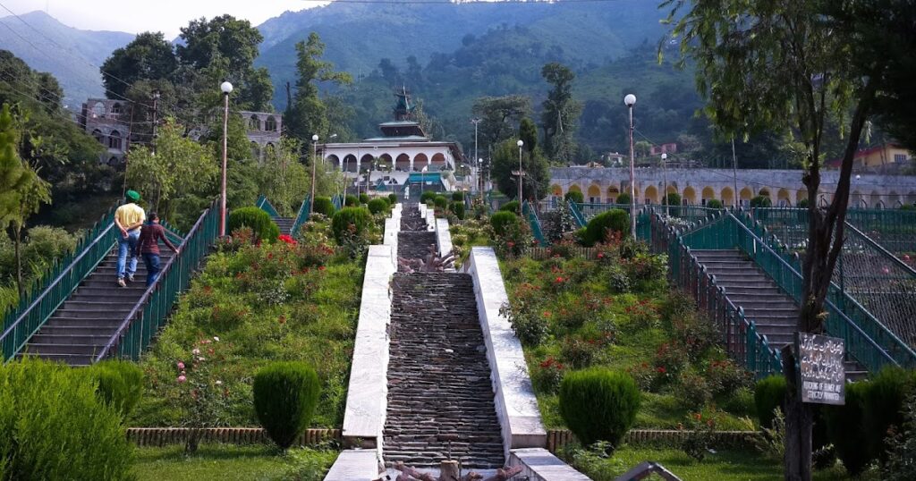
Shahdara Sharief
The Ziyarat Baba Ghulam Shah Badshah (R.A) Shahdara Sharief is located in the mid-north edge of district Rajouri at 33.30° north latitude and 74.26° east longitude. The altitude of the Ziyarat Sharief is 5807 feet above mean sea level. Being located in the lap of Middle Mountains (Pir Panjal) range of the Himalayas, the average temperature remains about 20°C annually. However, it falls to 1°C during winter with snowfall and rises up to 30°C during the hottest days of June. Normally, the area falls in a temperate mountain climate zone. The amusing geography and natural beauty of Shahdara resemble the valley of Kashmir. Shahdara Sharief is surrounded by Manu Naka in the east, Bagla Kopra Top in the west, Dehragalli (5900 ft) in Neza Peer, and Chamrede Galli in the north. Every season at Shahdara Sharief is unparalleled and enticing—spring flowers spread scent, summer brings lush greenery, and winter covers the land in snow-clad peaks and a white blanket at the footsteps of the Dargah. Shahdara is famously known as “Sein Dara”—where “Sein” means Lion and “Dara” means abode. Before the arrival of Baba (R.A.), this place was named Sein Dara, which later changed to Shahdara Sharief.
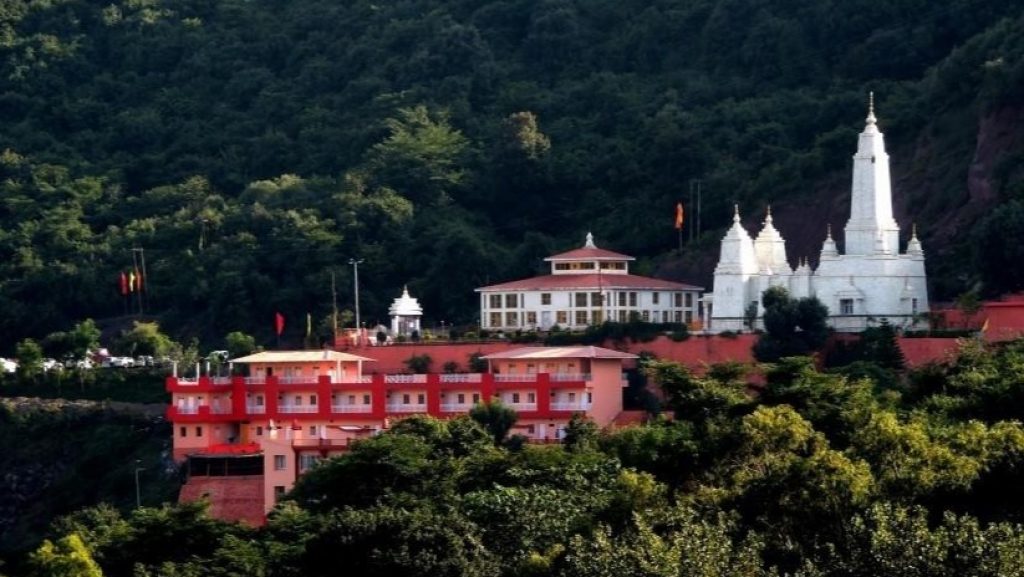
Doodadhari Temple
Dudhadhari Temple, also known as Dudhadhari Barfani Ashram, is situated in Rajouri. The temple was built in memory of Saint Dudhadhari Baba, who is believed to have survived only on milk. This is the tallest temple in Rajouri.
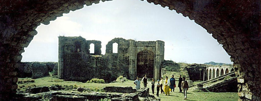
Dhanidhar Fort
In 1819, Maharaja Ranjit Singh captured Rajouri while conquering Kashmir and appointed Mirza Raheem Ullah Khan as its ruler, replacing Raja Agar Khan. He governed Rajouri under the Khalsa Darbar Lahore until 1846. On 15th March 1846, the British sold Jammu, Kashmir, and Ladakh to Raja Gulab Singh, bringing Rajouri under his rule. Due to strained relations, Maharaja Gulab Singh ordered Raheem Ullah Khan to step down. When he refused, Gulab Singh’s forces dismissed him on 26th October 1846, forcing him and his family into exile. Mian Hathu was then appointed Governor of Rajouri (1846-1856). During his rule, he began constructing Dhannidhar Fort, completed in 1855 AD, using materials from buildings destroyed during Maharaja Ranjit Singh’s invasion. The fort served as a strategic defense post for Dogra Forces and as a storage facility for collected grain, which was later sold.
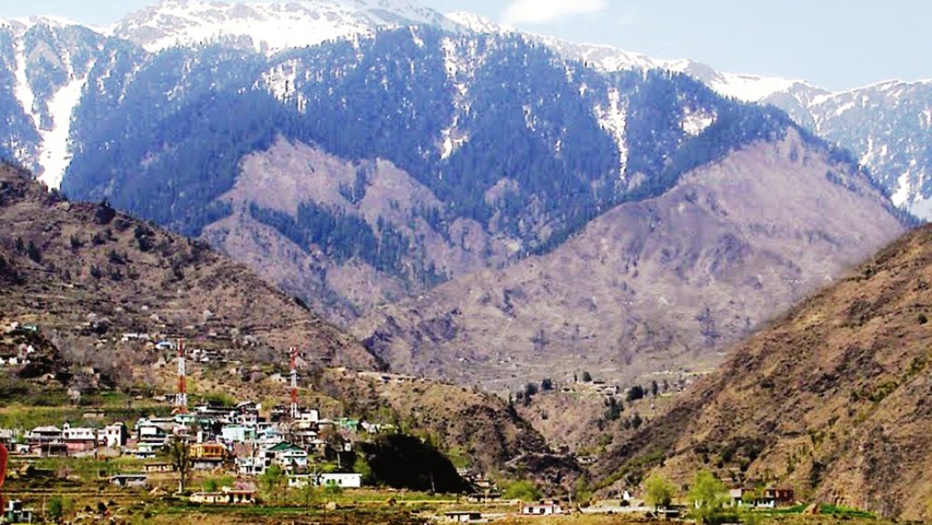
Kotranka Budhal
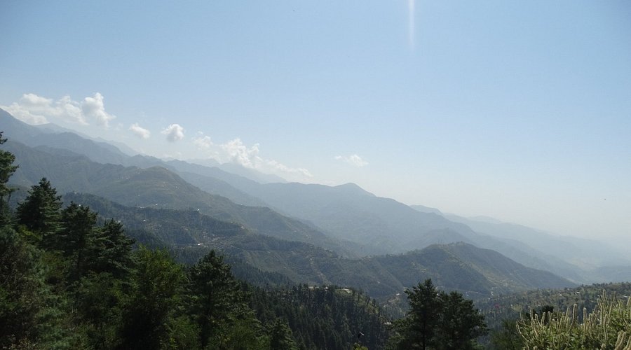
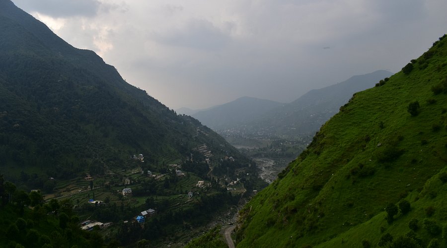
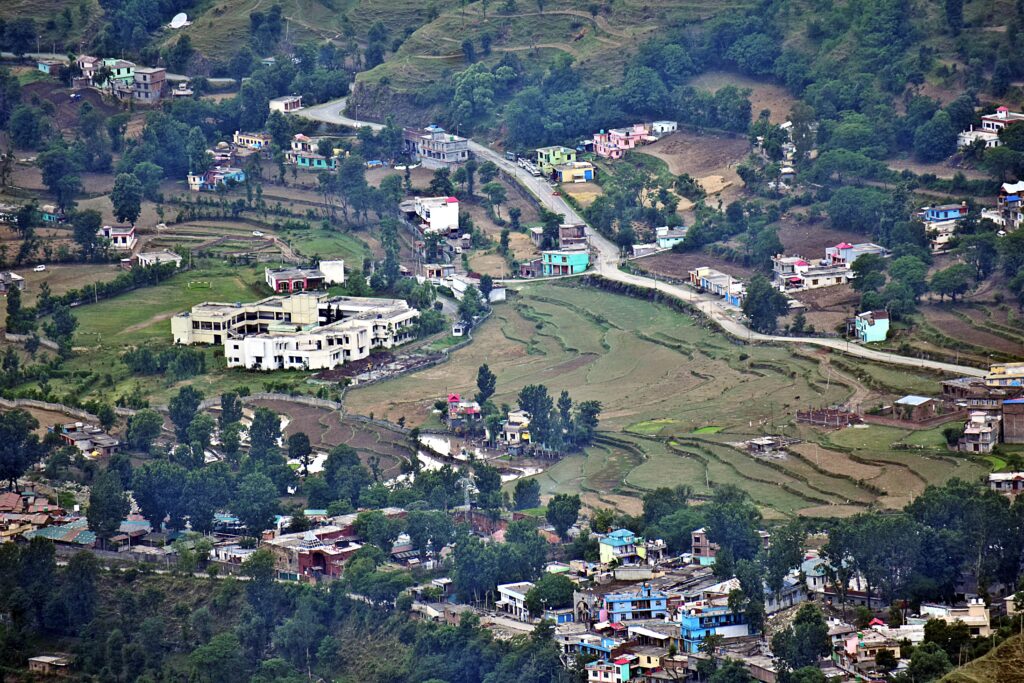
Kotranka, located 40 km away, is a scenic tourist spot on the right bank of River Ans. It attracts nature lovers and tourists, especially in summer, offering a picturesque and peaceful retreat. Currently, Kotranka is the tehsil headquarters of Budhal, the largest tehsil in the district. The name Budhal comes from a type of hardwood found in Pir Panjal. It is the coldest place in Rajouri, remaining snow-covered for over four to five months. The town serves as a base camp for trekkers and nomads traveling to Arnas and Sedhue, making it a key route to Kashmir Valley. Nearby, Klhad is a beautiful plateau where the water remains cold in summer and warm in winter. Another attraction, Nambal, is 6 km from Budhal, known for its natural beauty. Though Rajouri is not yet a major tourist destination, district authorities are working to develop tourist infrastructure at Chingus, Rajouri, and Dera-ki-Gali. The efforts of the Special Commissioner, Rajouri-Poonch, are commendable, as he documented the lakes and meadows of Pir Panjal in a video film that was telecasted twice by Doordarshan.
Dehra ki Gali
This beautiful scenic spot is situated at a height of 6,600+ feet above sea level in the Pir Panjal Range and is one of the passes connecting Rajouri and Poonch districts. It experiences heavy snowfall during winter months. The thick vegetation cover attracts and charms visitors. On the top of this hill, Project Beacon has constructed a one-room apartment, which is indeed a fine sightseeing spot for the entire area. The State PWD Department has recently constructed a two-room inspection hut, which can be rented out to visitors by the Executive Engineer, R&B, Rajouri, but no advance booking is required. It would be beneficial if the government constructs more huts to boost tourism in this region. The famous shrine of Rattan Pir is also situated nearby.
Darhal Malkan
In the northeast of Rajouri town, at a distance of 25 km, Darhal Malkan, a bowl-shaped valley surrounded by gently sloping mountains, is situated. Nature seems to have carved a natural stadium, which could attract thousands of sports lovers if proper sports facilities were developed. En route to Darhal is the Khanghah of Sain Ganj Baba, adding religious significance to this area. The perennial flow of crystal-clear water in Darhal Tawi further enhances its scenic beauty.
Thanamandi
This is an important historical place dating back to the Mughal era, when Mughal emperors stayed here during their journeys between Delhi and Kashmir. An old Mughal Sarai still exists, reflecting its glorious past. The climate is charming, making it a natural health resort. This place is also famous for its artistic wooden products. The famous Shrine of Shahdara Sharief is located just 6-7 km from here.